Non-map-based Visualization
of Geospatial Data Sets
—
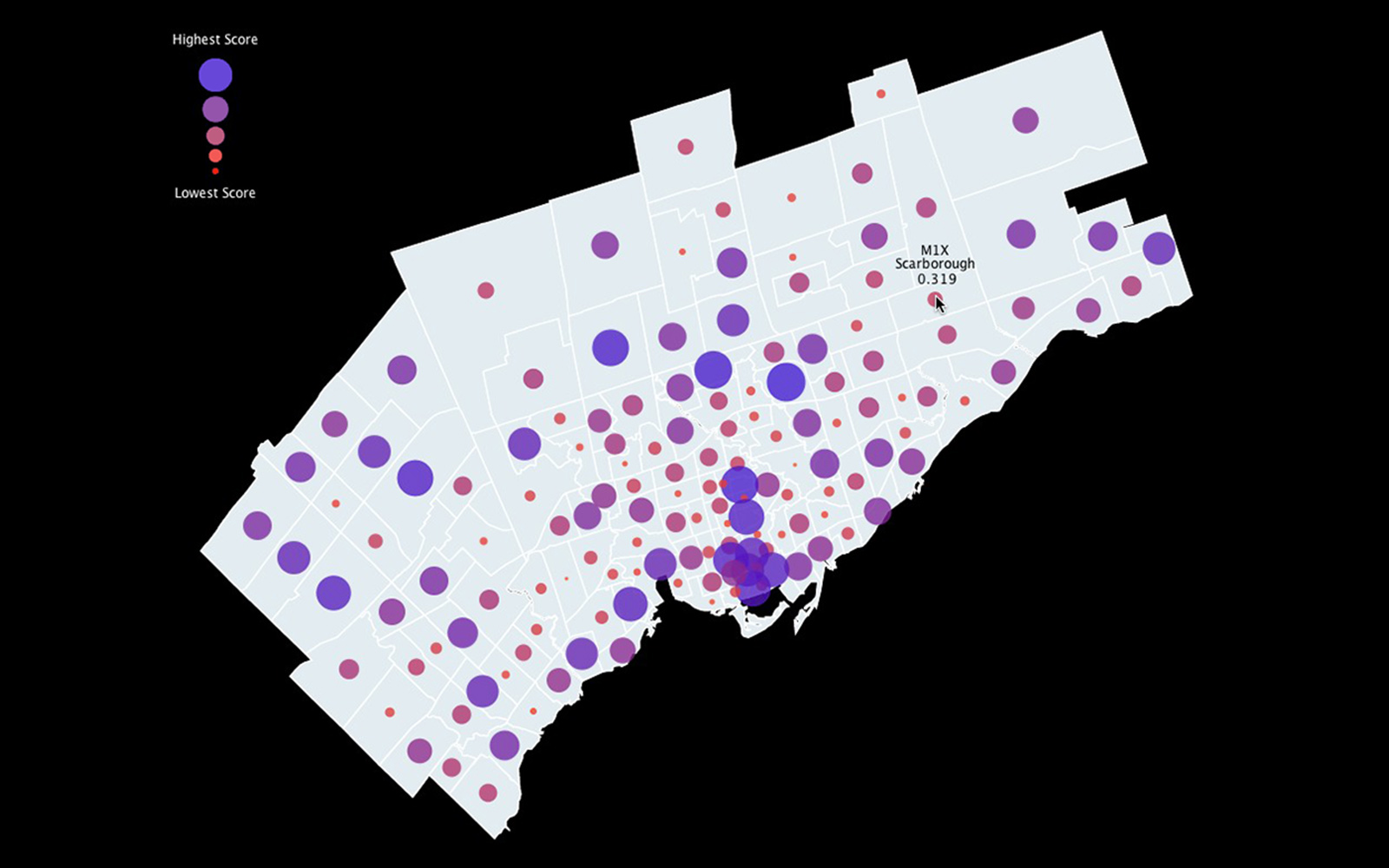
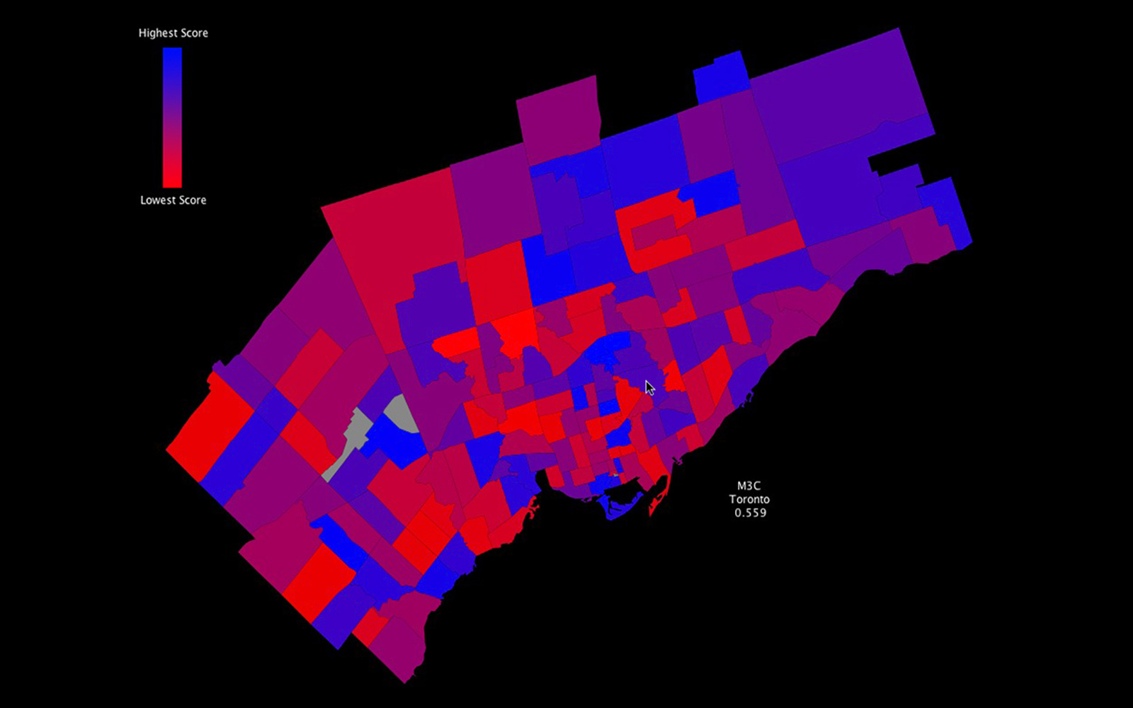
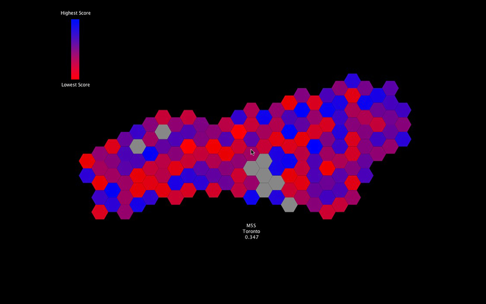
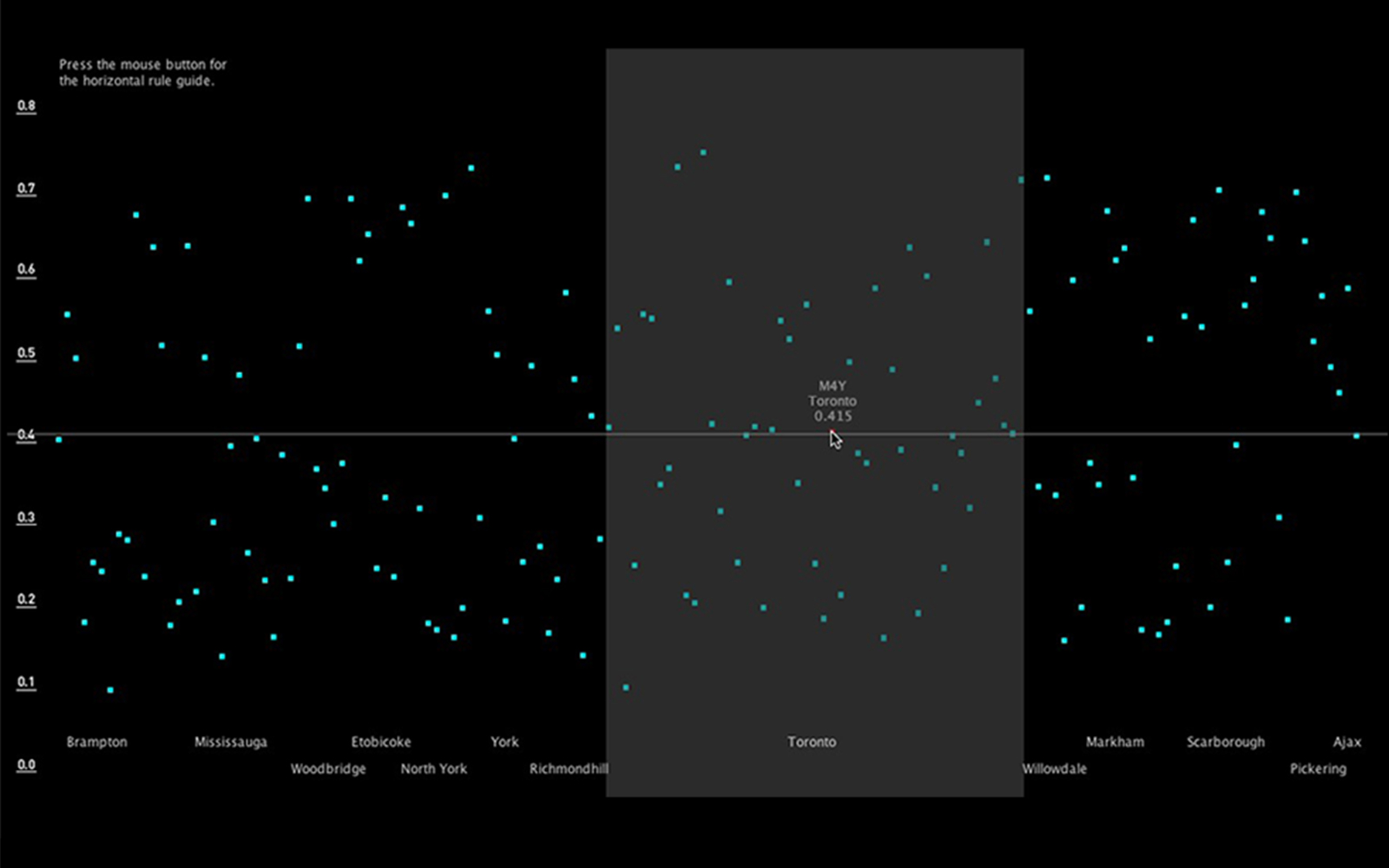
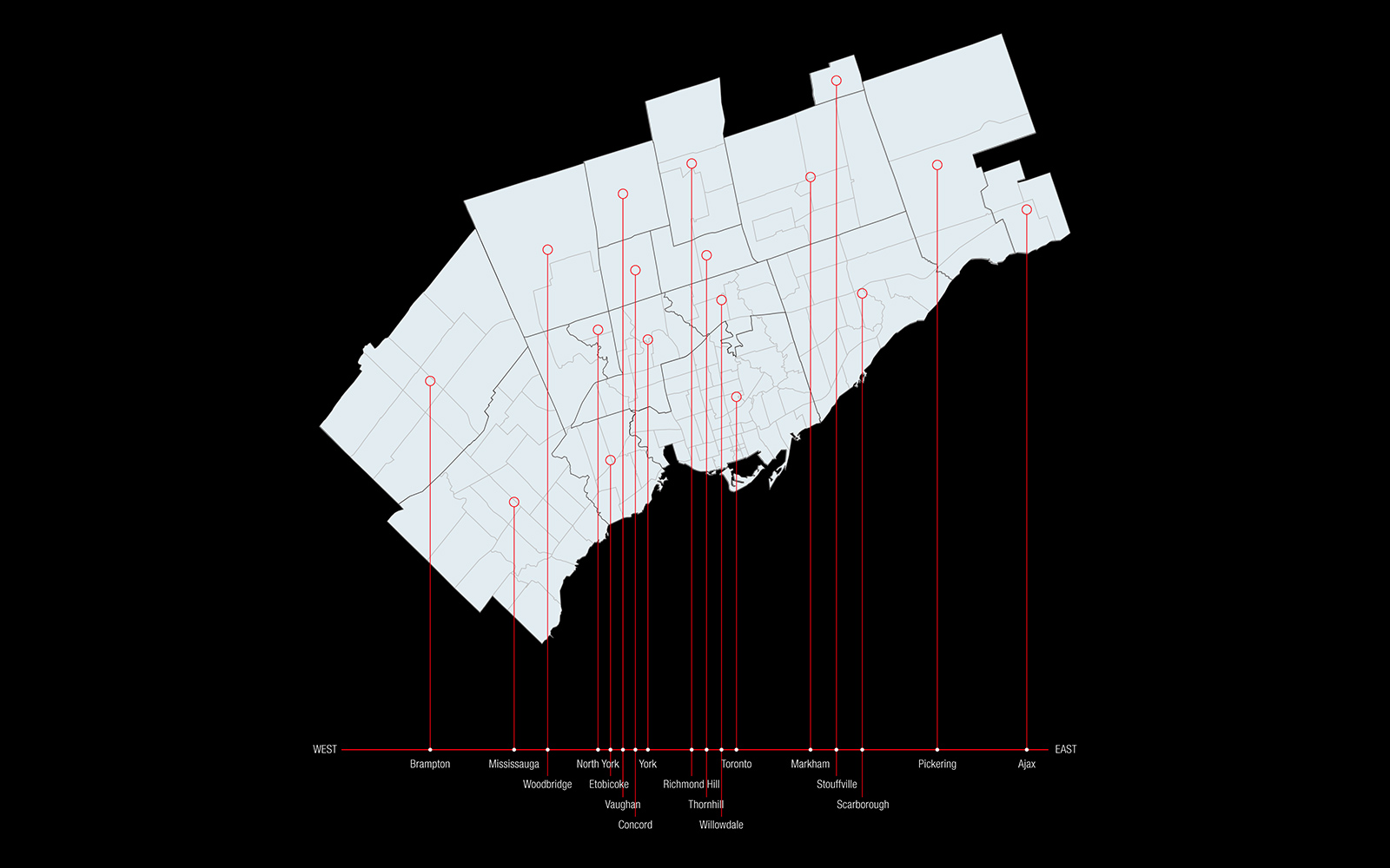
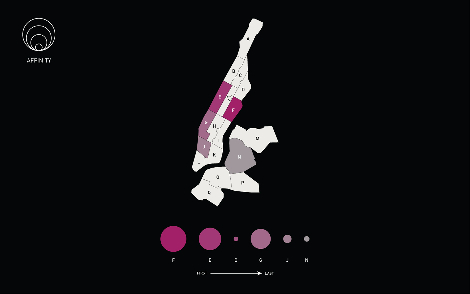
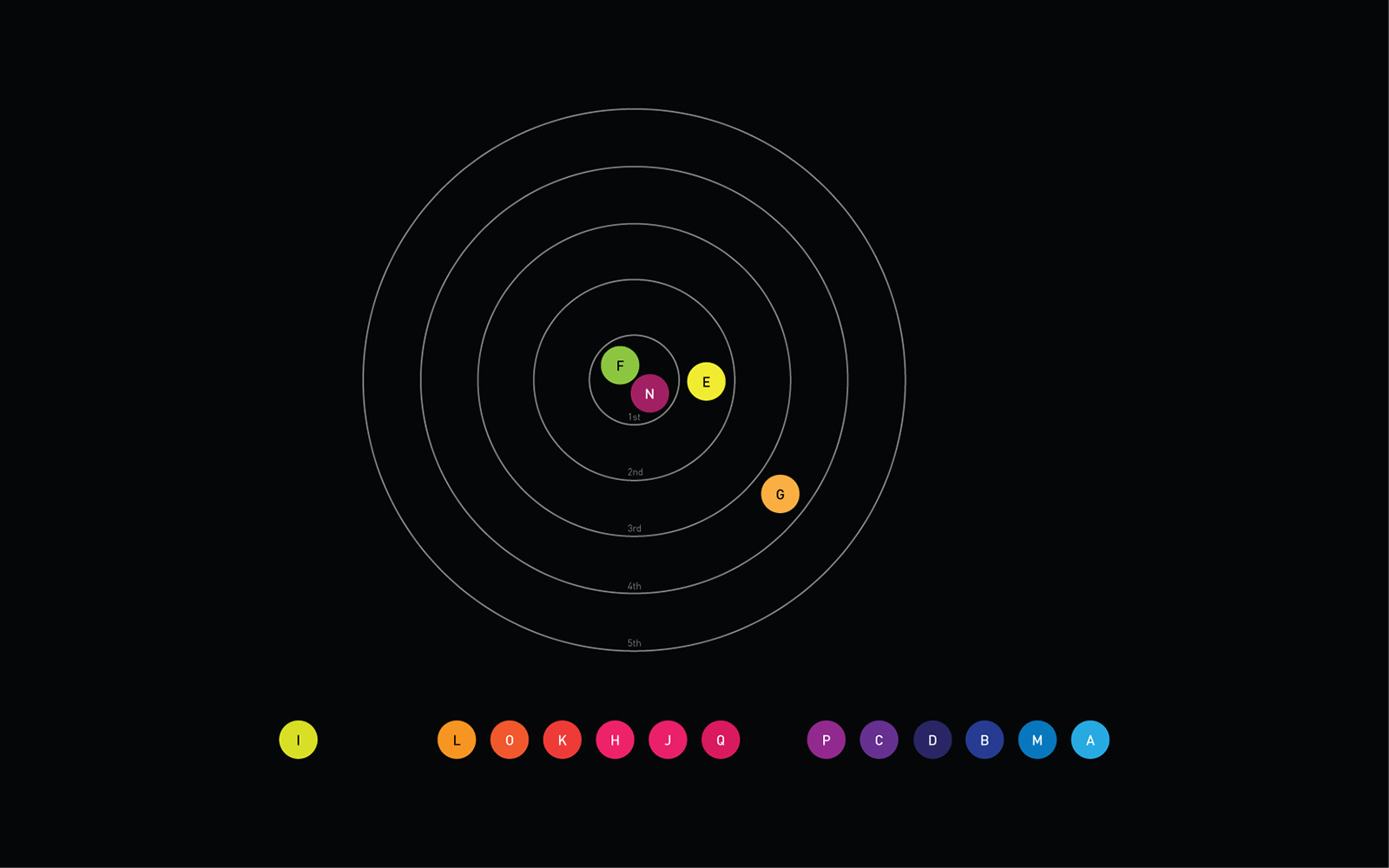
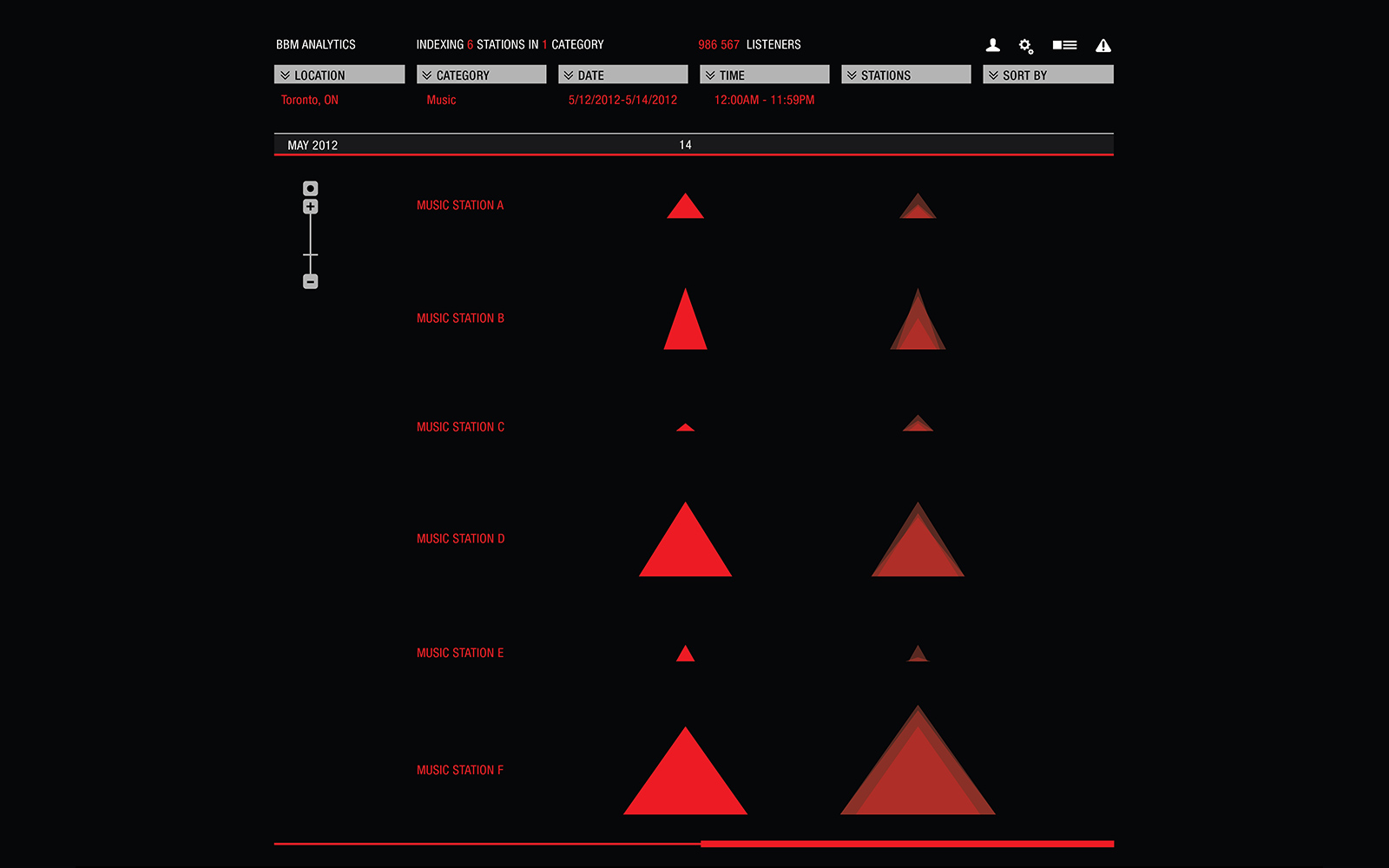
The most common means of visualizing data sets with geospatial data is by employing map-based visualization models such as graduated symbol and choropleth. Although these models might be well suited for geographic analysis and spatial navigation, they are not optimal for representing the actual values of data points.
—
Read the full study